
RTK GPS and Its Impact on Marine Navigation
Introduction
Marine navigation has come a long way from relying on celestial bodies and compasses. Today, the incorporation of advanced satellite technologies has revolutionized how vessels move through open waters. One of the most impactful technologies in recent years is rtk gps—Real-Time Kinematic Global Positioning System. This high-precision navigation tool is transforming how marine operations are conducted, from shipping to surveying.
What is RTK GPS?
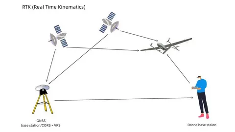
RTK GPS is a technique that enhances the accuracy of standard GPS by using a fixed base station and a mobile receiver. While standard GPS can provide accuracy within 3 to 5 meters, RTK GPS improves this to a range of 1 to 2 centimeters in real-time. It achieves this by correcting satellite data using the known position of the base station.
Applications of RTK GPS in Marine Navigation
1. Precise Route Planning
One of the most significant impacts of RTK GPS on marine navigation is its ability to support highly accurate route planning. This is particularly useful in narrow waterways, harbors, and docking areas where even minor deviations can lead to collisions or grounding.
2. Hydrographic Surveying
In hydrographic surveying, where precise seabed mapping is required, RTK GPS provides the positional accuracy needed to collect reliable data. Survey vessels can follow exact grid lines, ensuring comprehensive and repeatable coverage of the seabed.
3. Autonomous and Remote-Controlled Vessels
The growing field of autonomous marine vessels relies heavily on technologies like RTK GPS. Accurate positioning is crucial for these vessels to navigate safely and efficiently without human intervention.
Benefits Over Traditional GPS Systems
- Increased Safety: With more accurate positioning, the risk of accidents in crowded or narrow waterways is reduced.
- Efficiency Gains: Better navigation accuracy leads to fuel savings and more efficient route management.
- Data Quality: RTK GPS ensures high-quality data for marine construction and scientific research.
Challenges and Considerations
While RTK GPS and its impact on marine navigation is undeniably positive, some challenges exist. These include the need for a stable communication link between the base station and the rover (mobile unit) and signal interference in harsh weather conditions or remote locations.
Conclusion
The integration of RTK GPS in marine navigation marks a significant advancement in maritime technology. Its unparalleled accuracy is enhancing safety, improving efficiency, and opening new doors in marine exploration and automation. As technology continues to evolve, the role of RTK GPS in marine industries will only grow, making it an indispensable tool for modern navigation.